Hawai‘i Association of Watershed Partnerships

Donate

  • About
    • About HAWP
    • Making a Critical Difference
    • Contact Us
  • Watershed Partnerships
    • East Maui
    • East Moloka’i
    • Kaua’i Watershed Alliance
    • Kohala Watershed Partnership
    • Ko’olau Mountains
    • Mauna Kahālāwai Watershed
    • Mauna Kea Watershed Alliance
    • Three Mountain Alliance
    • Uhiwai O Haleakalā
    • Wai’anae Mountains
  • Watersheds
    • Learn About Watersheds
  • Resources
    • Resource Library
    • Helpful Links
  • Get Involved
  • News & Updates
Clouds MK
MKWA Logo

Mauna Kea Watershed Alliance

History & Mission

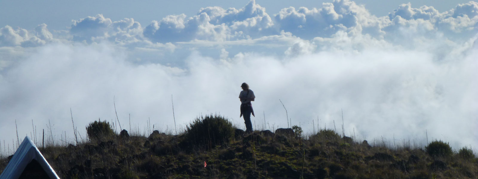
Mauna Kea or Mauna a Wākea (Mountain of Wākea), the tallest mountain in the State of Hawaiʻi, is rich in cultural, biological, economic, and watershed resources, and acknowledged as the birthplace of humans in The Kumulipo (Hawaiian Creation Chant). Mauna Kea holds deep cultural significance to Hawai‘i’s people, standing as a focal point of Native Hawaiian culture and spirituality and its forests are birthplaces of legends. However due to land modifications and alien introductions that are representative of Hawai‘i’s history and evolving economy, they are now home to rare and increasingly threatened native species and ecosystems. Today, Mauna Kea is the primary water source for the Big Island, and the mountain slopes are the food and fiber basket of Hawai‘i Island, making it essential to the island’s water, food, and fiber security.

In 2008, the State Department of Land and Natural Resources (DLNR), a partner in most of the watershed partnerships, began contemplating a watershed alliance for Mauna Kea on Hawai‘i Island. A Mauna Kea Watershed Partnership Scoping Study assessed the feasibility of forming a Mauna Kea Watershed Alliance. The study identified key threats to these important resources including: invasive species, feral ungulates, and wildfire; and recommended establishing a watershed alliance for Mauna Kea, focusing on large landowners (>1,000 acres) above 2,000-ft. elevation.

A Memorandum of Understanding was drafted for the Alliance and signed in 2010 by seven founding partners, five landowning partners––DLNR and the Department of Hawaiian Home Lands (state agencies), Hakalau Forest National Wildlife Refuge (federal agency), and Kūkaʻiau Ranch and Kamehameha Schools (private landowners) and two non-landowning/ affiliate partners, The Nature Conservancy and the U.S. Department of Interior Pacific Islands Fish and Wildlife Office. Since the watershed manager was hired in 2011, three more partners have joined the Alliance: landowning partners Lili‘uokalani Trust and Parker Ranch, and affiliate partner the U.S. Forest Service-Institute of Pacific Islands Forestry.

The perpetuation of this area’s richness depends on our ability to work together and serving as stewards to protect its unique resources for current and future generations. The current Alliance boundary encompasses ~ 416,000 acres on Mauna Kea and abuts the Three Mountain Alliance to the south and the Kohala Mountain Watershed Partnership to the north.

Partners

  • Hawai‘i Department of Land and Natural Resources
  • Parker Ranch
  • Hawai‘i Department of Hawaiian Home Lands
  • Hakalau Forest National Wildlife Refuge
  • Kūkaʻiau Ranch
  • Kamehameha Schools
  • Lili‘uokalani Trust
  • The Nature Conservancy
  • Pacific Islands Fish and Wildlife Office
  • Institute of Pacific Islands Forestry

Our Logo

The Mauna Kea Watershed Alliance consists of three elements; the snow capped Mauna Kea home to the goddess Poli‘ahu that represents the water captured in snow as well as other water goddess (i.e. Lilinoe/the afternoon mists that rise onto the east part of Mauna Kea in the early afternoon), the foundational plants representing the dominant native forest types at high elevation including koa and mamane that are responsible for water capture and storage in Hawai‘i aquifers, and the MKWA logo and droplet of water highlighting the Watershed Partnership area where landholders work together to protect and restore native forests

MKWA Logo

Management Priorities

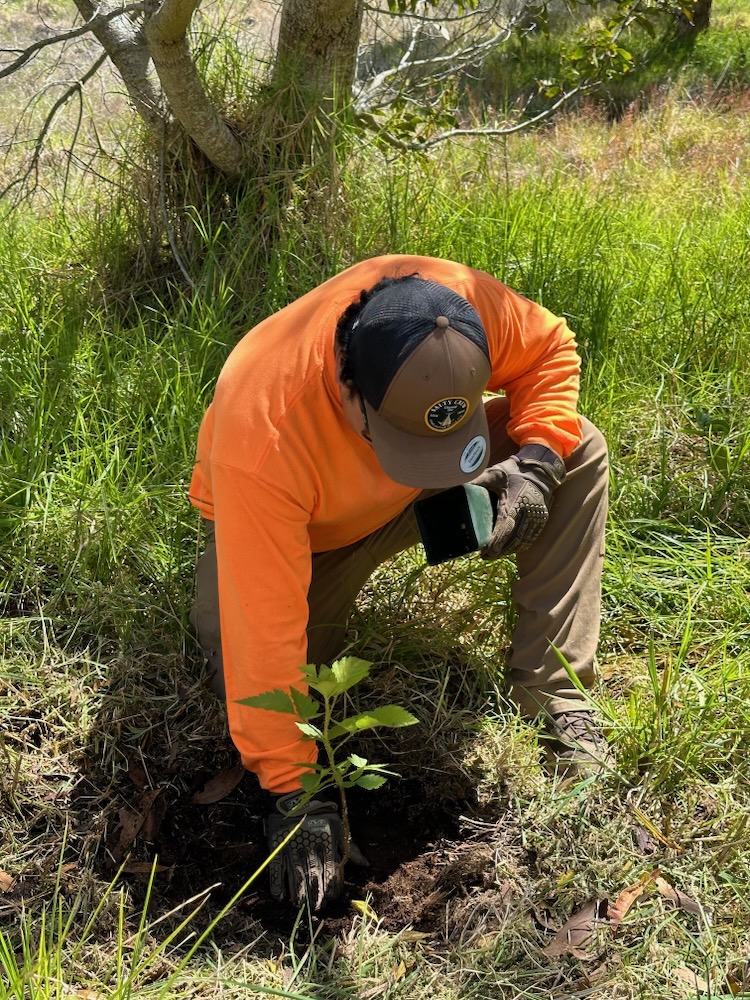
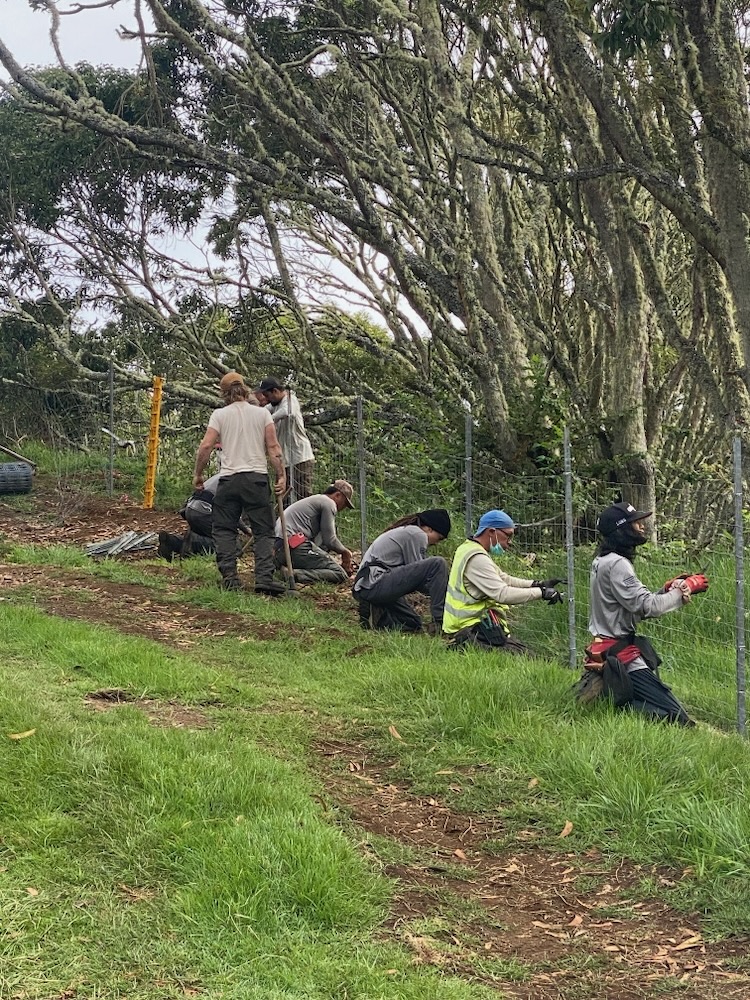
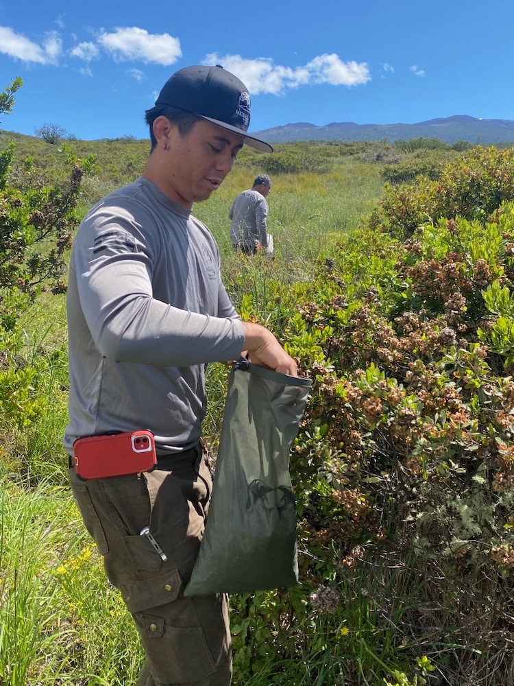
The Mauna Kea Watershed Alliance (MKWA) helps to coordinate watershed management projects that protect and restore native forests on Mauna Kea. Current management priorities include restoring the 525-acre Kanakaleonui Bird Corridor, protecting the 1,100-acre Waipahoehoe Management Unit, and Partner Assistance Projects. The MKWA conducts on-the-ground watershed management to install and maintain management units, manage feral ungulates and weeds, conduct monitoring, native forests restoration, environmental education, and workforce development.

The MKWA has recently completed several management projects such as out-planting native trees at the Kanakaleonui Bird Corridor, helicopter driving feral cattle from the Waipahoheoe Management Unit, and working with and completing numerous partnership projects with the State Division of Forestry and Wildlife, Hakalau Refuge, and Department of Hawaiian Home Lands.

MKWA field crew member conducts helicopter operations to move fence material from the staging area to the Hilo Forest Reserve, Mauna Kea, Hawai‘i.
MKWA field crew members install predator proof fence to protect the endangered Hawaiian petrel (Pterodroma sandwichensis) from feral cats on the eastern slope of Mauna Kea, Hawai‘i.
MKWA field crew member plants native tree’s to increase forest diversity at the Kanakaleonui Bird Corridor, Mauna Kea, Hawai‘i.
MKWA field crew works with Hakalau Refuge staff to install protective fence lines, Mauna Kea, Hawai‘i.

Click any image to view in a slideshow.

Ecosystem Highlights

Mauna Kea is a dormant shield volcano on the island of Hawaiʻi. Its peak is 13,803 ft above sea level, making it the highest point in Hawai‘i and some call Mauna Kea the tallest mountain in the world, from its underwater base. From the Hawaiian perspective, the peaks of the island of Hawaiʻi are sacred and in ancient law only high-ranking aliʻi (chief) were allowed to visit its peak. Ancient Hawaiians living on the slopes of Mauna Kea relied on its extensive forests for food, and quarried the dense volcano-glacial basalts on its flanks for tool production. When Europeans arrived in the late 18th century, settlers introduced cattle, sheep, and game animals, many of which became feral and began to damage the volcano’s ecological balance.

Mauna Kea can be ecologically divided into three sections: an alpine climate at its summit, a Sophora chrysophylla–Myoporum sandwicense (māmane–naio) forest on its flanks, and an Acacia koa–Metrosideros polymorpha (koa–ʻōhiʻa) forest, now mostly cleared by the former sugar industry, at its base. MKWA projects are often between 5,200-8,000 feet elevation on the eastern slope of Mauna Kea with the aim to increase connectivity and protect/restore native forests contributing positively to the mountain’s overall health.

Mauna kea is also home to Hawaiian deities such as Polia‘hu (cloaked bosom), one of four water goddesses that reside there. It is Poliʻahu who spreads her beautiful white kapa across the summit of Mauna Kea in the winter, and adorns the mountain with her pink and gold cloak in the summer. This natural phenomenon can still be observed today when positioned at the right place and time.
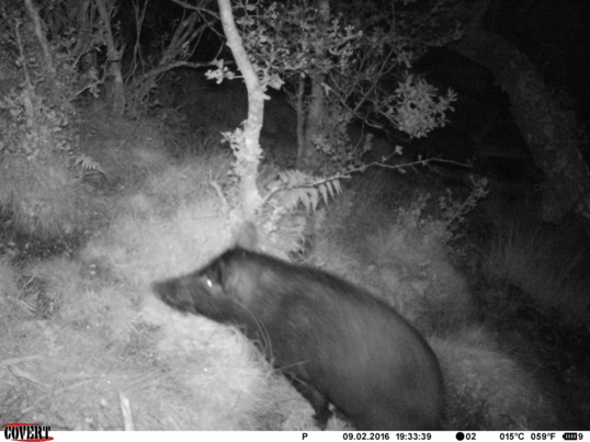
Top Threats

  • feral ungulates
  • invasive plant species
  • avian disease
  • climate change
MKWA field crew members install predator proof fence to protect the endangered Hawaiian petrel (Pterodroma sandwichensis) from feral cats on the eastern slope of Mauna Kea, Hawai‘i.
Feral pig captured via game cam, Mauna Kea, Hawai‘i.
One-way feral cattle gates are an effective no kill solution to remove feral cattle from management units, Mauna Kea, Hawai‘i.
One-way feral cattle gates at work on Mauna Kea, Hawai‘i.
From the ground view of Rapid ʻŌhiʻa Death (ROD) on Mauna Kea, Hawai‘i.
Imagery (courtesy American Forest) of the native bird corridor concept, native birds can escape avian disease carrying mosquitoes found at lower elevations by planting trees providing connectivity from 6,000-8,000 feet elevation on Mauna Kea, Hawai‘i (https://www.americanforests.org/article/bringing-songbirds-back-to-hawaii-one-forest-at-a-time/).
Wildland firefighter backburning to contain the Mana Road wildfire that happened on partnership lands in 2021 (https://dlnr.hawaii.gov/blog/2021/09/08/nr21-163/).

Click any image to view in a slideshow.

Native forests have been decimated from Rapid ʻŌhiʻa Death (ROD) on Mauna Kea, Hawai‘i. These three images show how native ʻŌhiʻa trees have been killed at landscape scale over the past ten years, it has been shown that wounding caused by feral ungulates can cause tree’s to be infected by ROD (https://storymaps.arcgis.com/stories/7f7a2bfd3ed142218998a7326f6006be).

Native forests have been decimated from Rapid ʻŌhiʻa Death (ROD) on Mauna Kea, Hawai‘i. These three images show how native ʻŌhiʻa trees have been killed at landscape scale over the past ten years, it has been shown that wounding caused by feral ungulates can cause tree’s to be infected by ROD (https://storymaps.arcgis.com/stories/7f7a2bfd3ed142218998a7326f6006be).

MKWA Area

MKWA Partners
MKWA Partner Lands

How You Can Help

Through our environmental education and outreach programs, we offer mainly field and service learning for community groups to connect with MKWA watersheds, contact Cheyenne at chperry@hawaii.edu if you are interested.

MKWA staff and HYCC transplanting pilo for restoration on Mauna Kea, Hawai‘i.

News, Updates, Job/Volunteer Openings:

To learn about opportunities, follow us on Instagram!
@mauna_kea_watershed_alliance

Or RCUH postings.

Media Gallery

KUPU HYCC and MKWA in the high elevation forests east slope of Mauna Kea, Hawai‘i.
MKWA conducting helicopter sling load training at Hilo airport, Hawai‘i.
MKWA crew hiking to worksite upper Hilo Forest Reserve, Hawai‘i.
KUPU HYCC conducting protocol at 8,000 feet elevation Mauna Kea, Hawai‘i.
Blue Water Exchange participant collection mamane seed for restoration at the Kanakaleonui Bird Corridor on Mauna Kea, Hawai‘i.
MKWA staff collecting a‘ali‘i seed for restoration on Mauna Kea, Hawai‘i.
MKWA staff and HYCC transplanting pilo for restoration on Mauna Kea, Hawai‘i.
MKWA staff at Kanakaleonui Bird Corridor Mauna Kea, Hawai‘i.
Fence install
Fence install
Clouds
Clouds
Chainsaw training
Chainsaw training
Blue Water Exchange
Blue Water Exchange
MKWA staff group pics at Hilo, Hawai‘i in 2024
MKWA staff group pics at Hilo, Hawai‘i in 2024.
MKWA staff group pics at Hilo, Hawai‘i in 2024

Click any image to view in a slideshow.

Resources:

  • Organization: https://maunakeawatershed.org

Contact Information

Cheyenne Perry
MKWA Manager
Mauna Kea Watershed Alliance
60 Nowelo Street
Hilo, HI 96720
chperry@hawaii.edu
808-937-5170

Social Media

Instagram: mauna_kea_watershed_alliance

Back to Watersheds

HAWP logo

Stay Connected

Contact Us

hawp@hawaii.edu

Support Us

Donate

Copyright © 2025 • Log in• Sitemap • Designed by Websites with Aloha